File:Equirectangular-projection.jpg
Jump to navigation
Jump to search

Size of this preview: 800 × 400 pixels. Other resolutions: 320 × 160 pixels | 640 × 320 pixels | 1,024 × 513 pixels | 1,280 × 641 pixels | 2,048 × 1,025 pixels.
Original file (2,048 × 1,025 pixels, file size: 937 KB, MIME type: image/jpeg)
Captions
Add a one-line explanation of what this file represents
Captions
| Description |
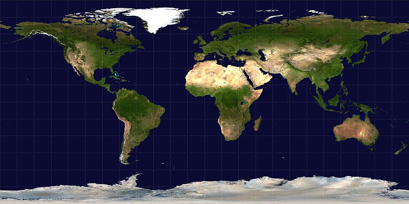
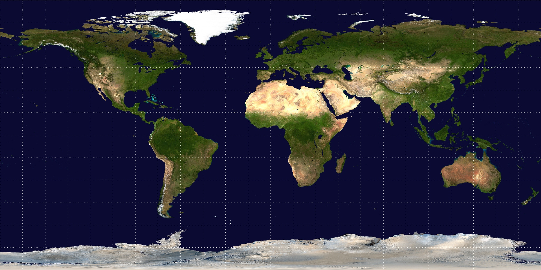
English: An equirectangular projection, with the equator as the standard parallel, of a Visible Earth image collected by the Earth Observatory experiment of the U.S. Government's NASA space agency. The reticle is 15 degrees in latitude and longitude.
|
|||||||||
| Author | original by NASA (sensor Terra/MODIS), modified by Mdf | |||||||||
| Date | (original), 2006 (modification by Mdf) | |||||||||
| Source | http://visibleearth.nasa.gov/: Info, Image. Modified by Mdf | |||||||||
| Geotemporal data | ||||||||||
| Bounding box |
|
|||||||||
| Georeferencing | ||||||||||
| Other versions | Derivative works of this file: Hoelzelbluemarble.png | |||||||||
Licensing[edit]
| This file is in the public domain in the United States because it was solely created by NASA. NASA copyright policy states that "NASA material is not protected by copyright unless noted". (See Template:PD-USGov, NASA copyright policy page or JPL Image Use Policy.) | ||
 |
Warnings:
|
File history
Click on a date/time to view the file as it appeared at that time.
| Date/Time | Thumbnail | Dimensions | User | Comment | |
|---|---|---|---|---|---|
| current | 15:06, 18 October 2006 | | 2,048 × 1,025 (937 KB) | Mdf (talk | contribs) | An equirectangular projection, with the equator as the standard parallel, of a Visible Earth image collected by the Earth Observatory experiment of the U.S. Government's NASA space agency. The reticle is 15 degrees in latitude and longitude. |
You cannot overwrite this file.
File usage on Commons
The following 6 pages use this file:
File usage on other wikis
The following other wikis use this file:
- Usage on ar.wikipedia.org
- Usage on cs.wikipedia.org
- Usage on de.wikipedia.org
- Usage on en.wikipedia.org
- Usage on en.wikiversity.org
- Usage on eo.wikipedia.org
- Usage on es.wikipedia.org
- Usage on fr.wikipedia.org
- Usage on fr.wikinews.org
- Usage on incubator.wikimedia.org
- Usage on ja.wikipedia.org
- Usage on pt.wikipedia.org
- Usuário(a):Santosga
- Wikipedia:Userbox/Localização
- Usuário:Pintopc
- Usuário:Bluedenim/Caixas
- Projeção cilíndrica equidistante
- Usuário(a):Akard~ptwiki
- Wikipedia:Userbox/Português no estrangeiro
- Usuário(a):Boaz Gabriel Canhoto
- Usuário(a):Oolong~ptwiki
- Usuário:Rbenzecry
- Usuário(a):HCa
- Usuário(a):DBRPOVOA
- Usuário:SevenCPA
- Usuário:Joao Astronomo
- Usuária:Athena in Wonderland/PU
- Usuário(a):Jerof37/Testes
- Usuário(a):Wiki0096
- Usage on ru.wikipedia.org
- Usage on simple.wikipedia.org
- Usage on uk.wikipedia.org