File:Helsinki map 1645 Vanhakaupunki.jpg
Jump to navigation
Jump to search

No higher resolution available.
Helsinki_map_1645_Vanhakaupunki.jpg (269 × 300 pixels, file size: 38 KB, MIME type: image/jpeg)
Captions
Add a one-line explanation of what this file represents
Captions
| Description |
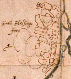
English: A map of Vanhakaupunki, Helsinki, Finland, 1645.
Suomi: Helsingin Vanhankaupungin kartta vuodelta 1645.
|
|||||||||
| Author | Hans Hansson | |||||||||
| Date | ||||||||||
| Source | http://www.nba.fi/helsinginarkeologiaa/popup/1645.htm National Board of Antiquities, Helsinki Original map: Riksarkivet, Stockholm |
|||||||||
| Geotemporal data | ||||||||||
| Bounding box |
|
|||||||||
| Georeferencing | ||||||||||
| Other versions |
Image:Helsinki map 1645.jpg Image:Helsinki map 1645 Vironniemi.jpg |
|||||||||
|
This work is in the public domain in its country of origin and other countries and areas where the copyright term is the author's life plus 100 years or fewer.
| |
| This file has been identified as being free of known restrictions under copyright law, including all related and neighboring rights. | |
File history
Click on a date/time to view the file as it appeared at that time.
| Date/Time | Thumbnail | Dimensions | User | Comment | |
|---|---|---|---|---|---|
| current | 22:44, 18 May 2008 | | 269 × 300 (38 KB) | Apalsola (talk | contribs) | {{Information |Description = {{en|A map of Vanhakaupunki, Helsinki, Finland, ca. 1645.}} {{fi|Helsingin Vanhankaupungin kartta vuodelta 1645.}} |Source = http://www.nba.fi/helsinginarkeologiaa/popup/1645.htm<br />National Board of Antiquities, Helsinki<b |
You cannot overwrite this file.
File usage on Commons
There are no pages that use this file.
File usage on other wikis
The following other wikis use this file:
- Usage on de.wikipedia.org
- Usage on et.wikipedia.org
- Usage on fi.wikipedia.org
- Usage on fr.wikipedia.org
- Usage on sv.wikipedia.org