File:Karte- Flughafen Berlin-Schönefeld SXF.png
Jump to navigation
Jump to search

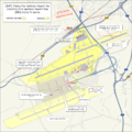
Size of this preview: 602 × 600 pixels. Other resolutions: 241 × 240 pixels | 482 × 480 pixels | 771 × 768 pixels | 1,028 × 1,024 pixels | 2,272 × 2,264 pixels.
Original file (2,272 × 2,264 pixels, file size: 1,002 KB, MIME type: image/png)
Captions
Add a one-line explanation of what this file represents
Captions
Summary[edit]
| Description |
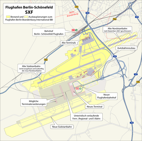
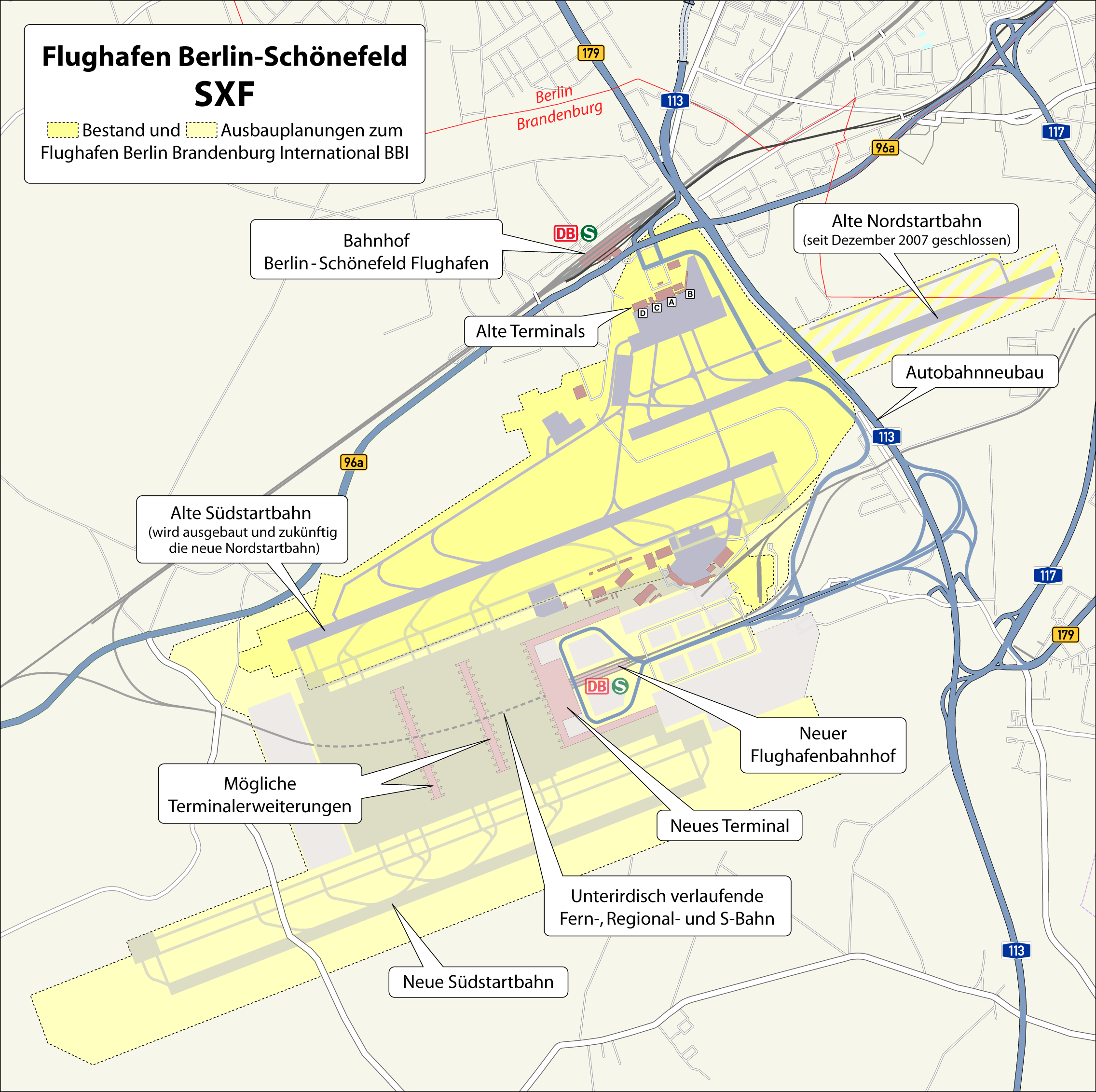
Deutsch: Karte: Flughafen Berlin-Schönefeld SXF mit Darstellung der Ausbauplanungen zum Flughafen Berlin Brandenburg International BBI
|
|||||||||
| Author | Maximilian Dörrbecker (Chumwa)
|
|||||||||
| Date | ||||||||||
| Source | Self made, using
|
|||||||||
| Permission (Reusing this file) |
I, the copyright holder of this work, hereby publish it under the following license:
Sie dürfen das Bild zu den folgenden Bedingungen nutzen:
|
|||||||||
| Geotemporal data | ||||||||||
| Bounding box |
|
|||||||||
| Georeferencing | ||||||||||
| Other versions |
|
|||||||||


|
This architecture image could be re-created using vector graphics as an SVG file. This has several advantages; see Commons:Media for cleanup for more information. If an SVG form of this image is available, please upload it and afterwards replace this template with
{{vector version available|new image name}}.
It is recommended to name the SVG file "Karte- Flughafen Berlin-Schönefeld SXF.svg" – then the template Vector version available (or Vva) does not need the new image name parameter. |
File history
Click on a date/time to view the file as it appeared at that time.
| Date/Time | Thumbnail | Dimensions | User | Comment | |
|---|---|---|---|---|---|
| current | 05:20, 16 June 2008 | | 2,272 × 2,264 (1,002 KB) | Chumwa (talk | contribs) | Anmerkungen von Incontro eingearbeitet (vielen Dank hierfür!) |
| 18:55, 12 June 2008 | 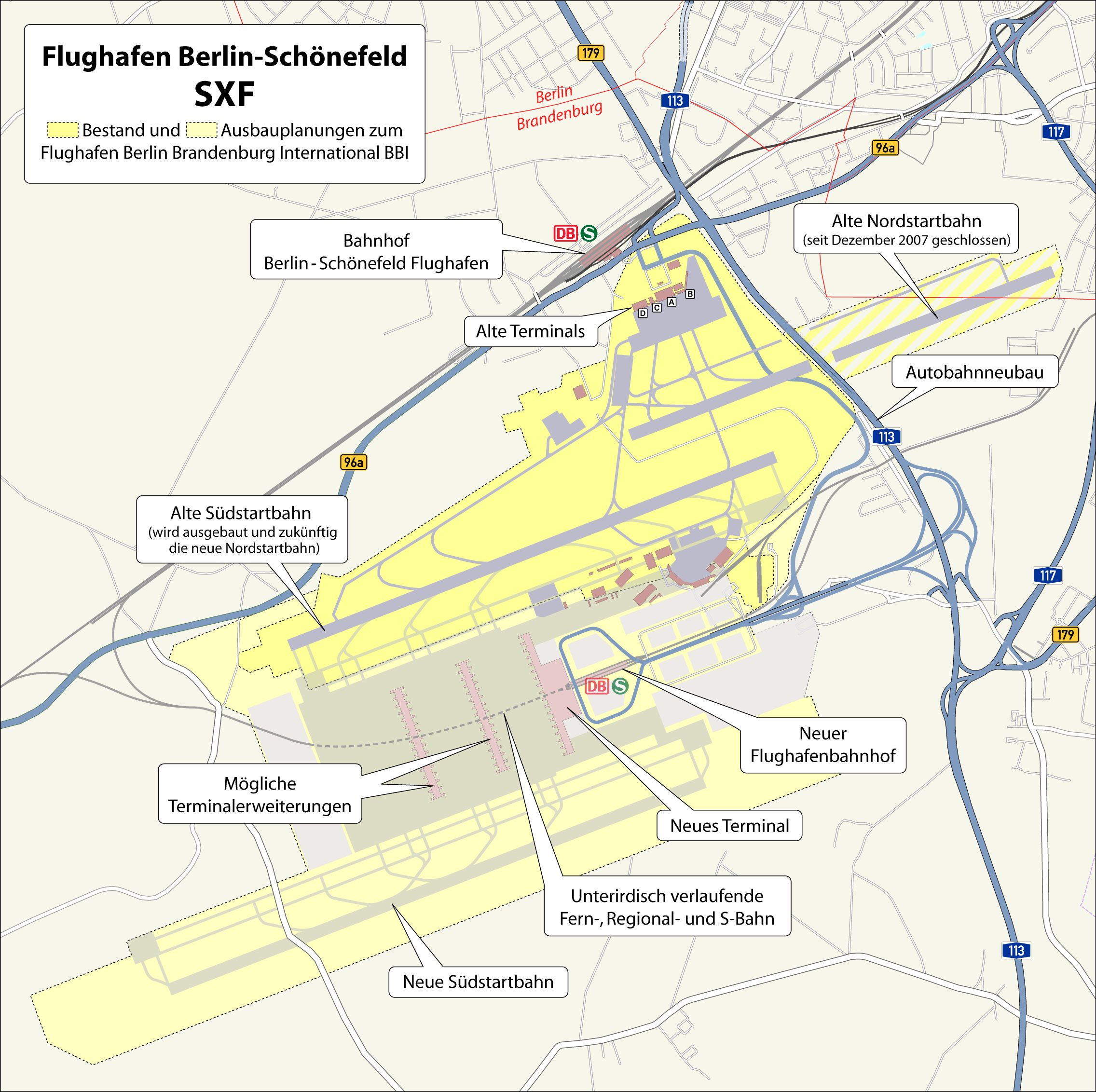 | 2,272 × 2,264 (1,003 KB) | Chumwa (talk | contribs) | Ergänzungen und Verbesserungen | |
| 05:51, 12 June 2008 | 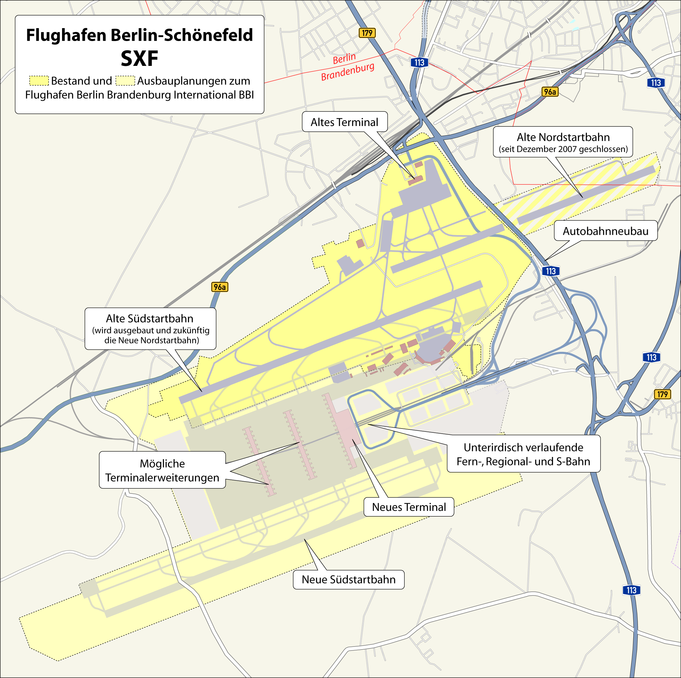 | 2,272 × 2,264 (995 KB) | Chumwa (talk | contribs) | einige Ergänzungen | |
| 21:50, 11 June 2008 |  | 1,636 × 1,630 (643 KB) | Chumwa (talk | contribs) | {{Information |Description={{en|1=abc}} |Source=Own work by uploader |Author=Chumwa |Date= |Permission= |other_versions= }} {{Information |Description= {{ de }} Karte: Flughafen Berlin-Schönefeld SFX mit Darstellung der Ausbauplanungen zu |
You cannot overwrite this file.
File usage on Commons
The following 7 pages use this file:
- Flughafen Berlin Brandenburg
- User:Chumwa/Gallery
- File:Karte- Flughafen Berlin-Schönefeld SFX.png (file redirect)
- File:Karte- Flughafen Berlin-Schönefeld SXF.png
- File:Karte Flughafen Berlin Brandenburg.png
- File:Map Berlin-Schoenefeld Airport SFX with planed BBI-HE.png
- File:Map Berlin-Schoenefeld Airport SFX with planed BBI.png
File usage on other wikis
The following other wikis use this file:
- Usage on de.wikipedia.org
- Usage on hu.wikipedia.org
- Usage on www.wikidata.org