File:Karte der Halbinsel Krim.jpg
Jump to navigation
Jump to search

No higher resolution available.
Karte_der_Halbinsel_Krim.jpg (711 × 463 pixels, file size: 318 KB, MIME type: image/jpeg)
Captions
Add a one-line explanation of what this file represents
Captions
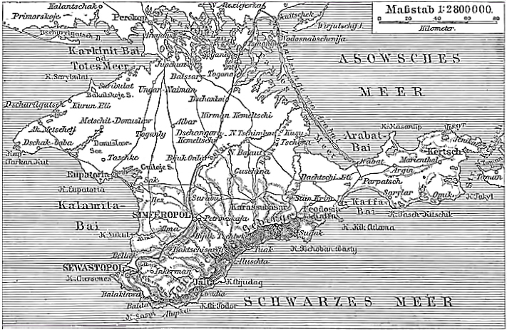
| This image comes from the 4th edition of Meyers Konversationslexikon (1885–90). The copyrights have expired and this image is in the public domain. |
|
This work is in the public domain in its country of origin and other countries and areas where the copyright term is the author's life plus 100 years or fewer. This work is in the public domain in the United States because it was published (or registered with the U.S. Copyright Office) before January 1, 1925. | |
| This file has been identified as being free of known restrictions under copyright law, including all related and neighboring rights. | |
File history
Click on a date/time to view the file as it appeared at that time.
| Date/Time | Thumbnail | Dimensions | User | Comment | |
|---|---|---|---|---|---|
| current | 18:04, 1 June 2013 | | 711 × 463 (318 KB) | DrJunge (talk | contribs) | got rid of jpeg artefacts and straighted the image. |
| 18:31, 11 December 2004 | 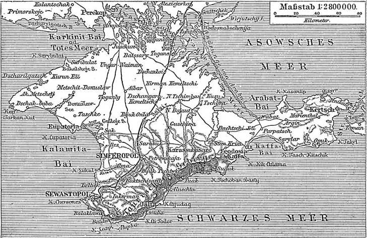 | 729 × 473 (97 KB) | ¡0-8-15! (talk | contribs) | {{PD-Meyers}} |
You cannot overwrite this file.
File usage on Commons
The following 4 pages use this file:
File usage on other wikis
The following other wikis use this file:
- Usage on af.wikipedia.org
- Usage on crh.wikipedia.org
- Usage on de.wikipedia.org
- Usage on en.wikipedia.org
- Usage on fi.wikipedia.org
- Usage on gl.wikipedia.org
- Usage on it.wikipedia.org
- Usage on ja.wikipedia.org
- Usage on la.wikipedia.org
- Usage on pl.wikipedia.org
- Usage on pl.wiktionary.org
- Usage on pt.wikipedia.org
- Usage on ru.wikipedia.org