File:Map.Dindigul District.Tamilnadu.AMS.jpg
Jump to navigation
Jump to search

Size of this preview: 785 × 600 pixels. Other resolutions: 314 × 240 pixels | 629 × 480 pixels | 1,006 × 768 pixels | 1,280 × 978 pixels | 5,000 × 3,819 pixels.
Original file (5,000 × 3,819 pixels, file size: 4.66 MB, MIME type: image/jpeg)
Captions
Add a one-line explanation of what this file represents
Captions
Summary[edit]
| Description |
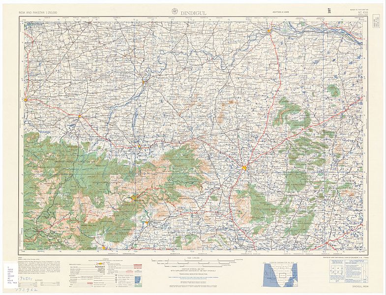
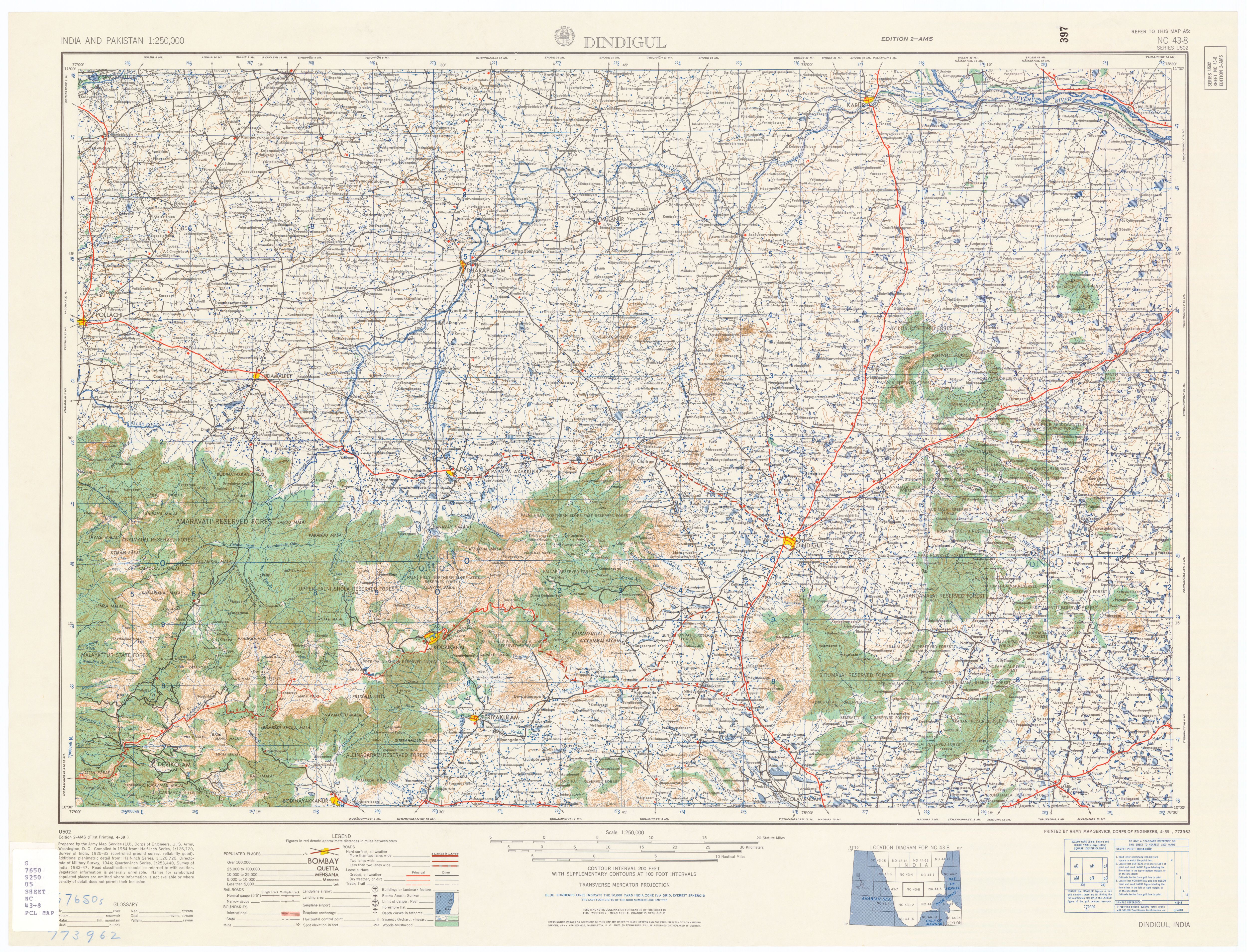
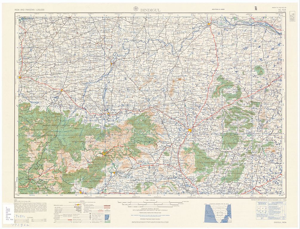
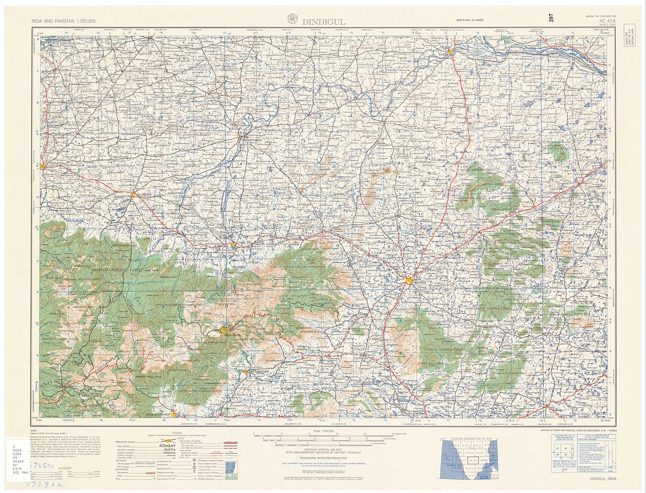
English: NC 43-8 Dindigul. Tile of the Map India and Pakistan 1:250,000. Series U502, U.S. Army Map Service, 1955
|
|||||||||
| Author | English: U.S. Army Map Service |
|||||||||
| Date | ||||||||||
| Source | https://www.lib.utexas.edu/maps/ams/india/ [1] | |||||||||
| Permission (Reusing this file) |
|
|||||||||
| Geotemporal data | ||||||||||
| Bounding box |
|
|||||||||
| Georeferencing | ||||||||||
| Other versions |
|
|||||||||
![[1]](../../legacy.lib.utexas.edu/maps/ams/india/nc-43-08.jpg)
Licensing[edit]
This work is in the public domain in the United States because it is a work prepared by an officer or employee of the United States Government as part of that person’s official duties under the terms of Title 17, Chapter 1, Section 105 of the US Code.
Note: This only applies to original works of the Federal Government and not to the work of any individual U.S. state, territory, commonwealth, county, municipality, or any other subdivision. This template also does not apply to postage stamp designs published by the United States Postal Service since 1978. (See § 313.6(C)(1) of Compendium of U.S. Copyright Office Practices). It also does not apply to certain US coins; see The US Mint Terms of Use.
|
.svg/64px-Great_Seal_of_the_United_States_(obverse).svg.png) | |
| This file has been identified as being free of known restrictions under copyright law, including all related and neighboring rights. | ||
File history
Click on a date/time to view the file as it appeared at that time.
| Date/Time | Thumbnail | Dimensions | User | Comment | |
|---|---|---|---|---|---|
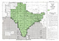
| current | 06:23, 26 January 2007 | | 5,000 × 3,819 (4.66 MB) | Marcus334 (talk | contribs) | {{Information |Description=Dingigul District,Tamil Nadu, India |Source=U.S. Army Topology Command |Date=1955 |Author=U.S. Army Map Service |Permission=Public Domain |other_versions= http://www.lib.utexas.edu/maps/ams/india/nc-43-08.jpg |all other district |
You cannot overwrite this file.
File usage on Commons
The following page uses this file:
- File:Map India and Pakistan 1-250,000 Tile NC 43-8 Dindigul.jpg (file redirect)
File usage on other wikis
The following other wikis use this file:
- Usage on en.wikipedia.org