File:OSM Pinelands map.svg
Jump to navigation
Jump to search


Size of this PNG preview of this SVG file: 618 × 600 pixels. Other resolutions: 247 × 240 pixels | 495 × 480 pixels | 791 × 768 pixels | 1,055 × 1,024 pixels | 1,358 × 1,318 pixels.
Original file (SVG file, nominally 1,358 × 1,318 pixels, file size: 6.65 MB)
Captions
Add a one-line explanation of what this file represents
Captions
Summary[edit]
| Description |
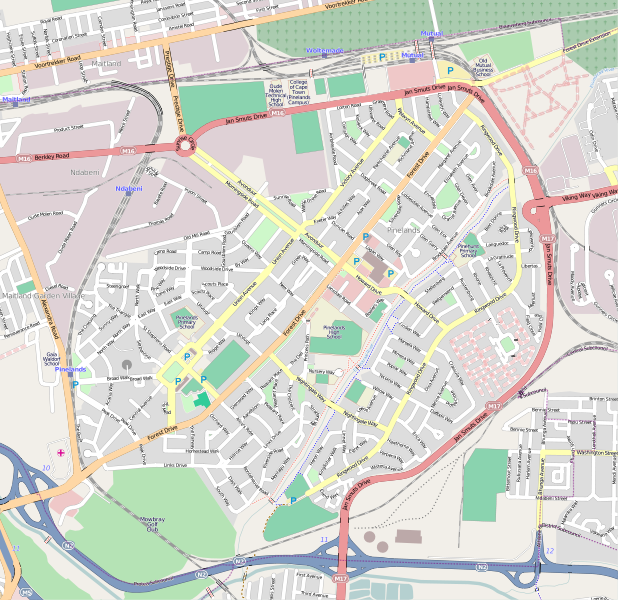
This map of Pinelands was created from OpenStreetMap project data, collected by the community. This map may be incomplete, and may contain errors. Don't rely solely on it for navigation. |
|||||||||
| Author | OpenStreetMap contributors | |||||||||
| Date | (see file history) | |||||||||
| Source | openstreetmap.org | |||||||||
| Permission (Reusing this file) |
OpenStreetMap data and maps are licensed under the Creative Commons Attribution-ShareAlike 2.0 license (CC-BY-SA 2.0).
|
|||||||||
| Geotemporal data | ||||||||||
| Bounding box |
|
|||||||||
| Georeferencing | If inappropriate please set warp_status=skip to hide. | |||||||||
| Other versions | File:OSM Pinelands map small.svg | |||||||||
File history
Click on a date/time to view the file as it appeared at that time.
| Date/Time | Thumbnail | Dimensions | User | Comment | |
|---|---|---|---|---|---|
| current | 07:58, 26 June 2010 | | 1,358 × 1,318 (6.65 MB) | Htonl (talk | contribs) | update |
| 11:55, 7 February 2009 |  | 1,424 × 1,318 (6.02 MB) | Htonl (talk | contribs) | update | |
| 19:20, 3 November 2008 |  | 1,468 × 1,334 (7.25 MB) | Htonl (talk | contribs) | new style, updated data | |
| 09:16, 27 April 2008 |  | 1,100 × 1,006 (5.76 MB) | Htonl (talk | contribs) | let's try that again | |
| 08:57, 27 April 2008 |  | 1,108 × 1,021 (5.87 MB) | Htonl (talk | contribs) | try newer, mapnik version | |
| 00:03, 29 November 2007 |  | 450 × 410 (1.84 MB) | Htonl (talk | contribs) | update | |
| 14:43, 21 October 2007 |  | 450 × 410 (1.62 MB) | Htonl (talk | contribs) | update, better size, remove border etc. | |
| 23:10, 20 October 2007 |  | 453 × 455 (2.07 MB) | Htonl (talk | contribs) | updated | |
| 19:00, 17 August 2007 |  | 460 × 434 (1.17 MB) | Htonl (talk | contribs) | updated versions | |
| 18:09, 28 March 2007 |  | 437 × 395 (1.21 MB) | Htonl (talk | contribs) | {{Information |Description=OpenStreetMap map of w:en:Pinelands, Cape Town as of 2007-03-28. |Source=w:en:OpenStreetMap data; map generated by osmarender4. |Date=2007-03-28 |Author=OpenStreetMap contributors; map generated by [[User:Htonl|Adria |
You cannot overwrite this file.
File usage on Commons
There are no pages that use this file.
File usage on other wikis
The following other wikis use this file:
- Usage on af.wikipedia.org
- Usage on en.wikipedia.org
- Usage on fr.wikipedia.org