File:Pacific-Northwest.jpg
Jump to navigation
Jump to search

Size of this preview: 800 × 543 pixels. Other resolutions: 320 × 217 pixels | 640 × 434 pixels | 1,024 × 695 pixels | 1,280 × 868 pixels | 10,339 × 7,014 pixels.
Original file (10,339 × 7,014 pixels, file size: 44.2 MB, MIME type: image/jpeg)
Captions
Add a one-line explanation of what this file represents
Captions
Summary[edit]
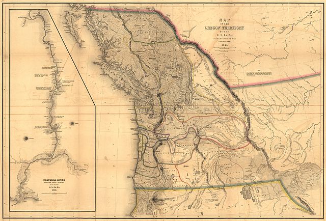
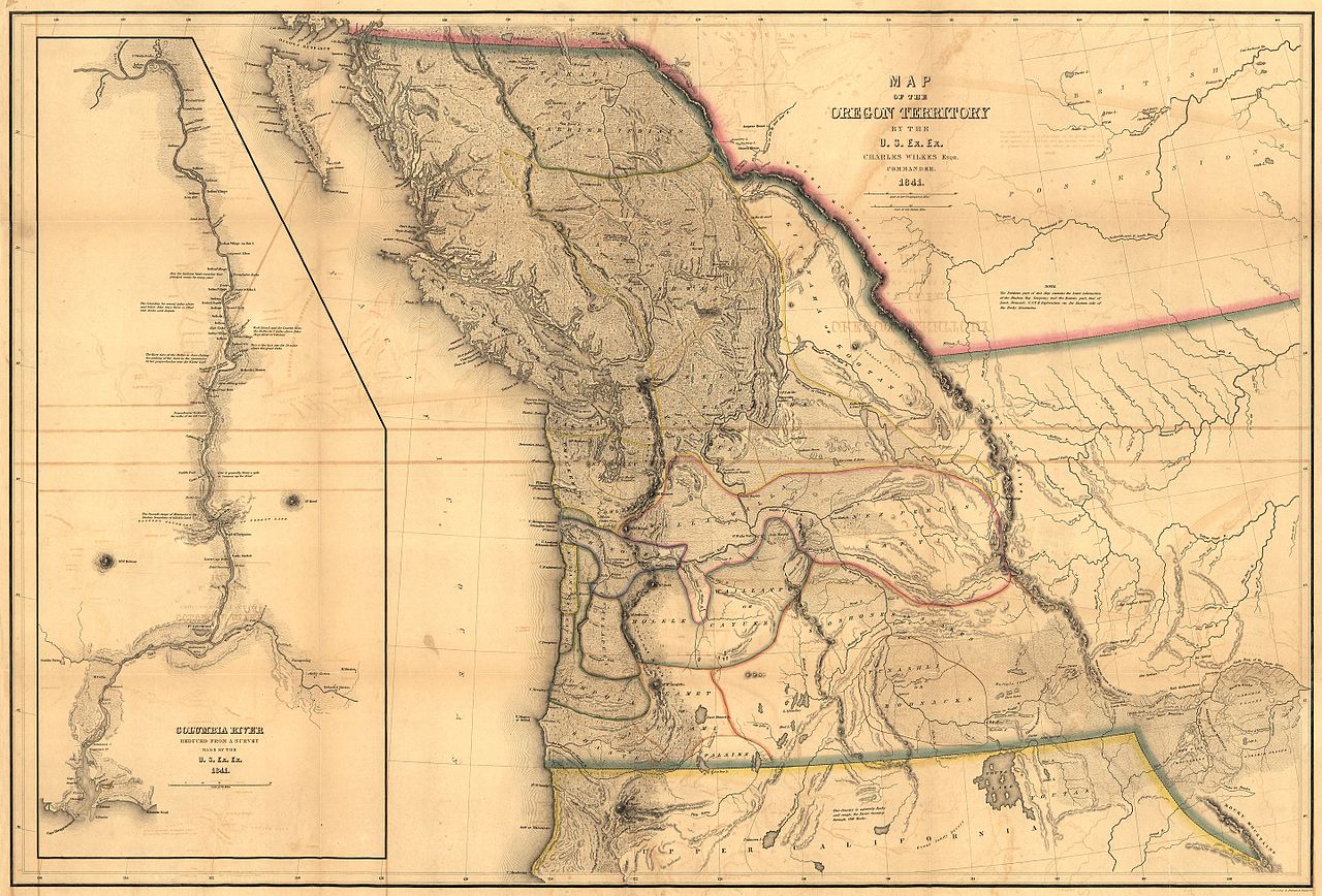
| Title | Map of the Oregon Territory | |||||||||||||||||||||||
| Description |
Map of the Oregon Territory by the U. S. Ex. Ex. |
|||||||||||||||||||||||
| Author | United States Exploring Expedition; Charles Wilkes | |||||||||||||||||||||||
| JPG development |
|
|||||||||||||||||||||||
| Date | ||||||||||||||||||||||||
| Source | https://www.loc.gov/item/2004627252 | |||||||||||||||||||||||
| Permission (Reusing this file) |
|
|||||||||||||||||||||||
| Geotemporal data | ||||||||||||||||||||||||
| Date depicted | ||||||||||||||||||||||||
| Map location | Columbia River; Pacific | |||||||||||||||||||||||
| Heading |
 |
|||||||||||||||||||||||
| Bounding box |
|
|||||||||||||||||||||||
| Georeferencing | If inappropriate please set warp_status=skip to hide. | |||||||||||||||||||||||
| Bibliographic data | ||||||||||||||||||||||||
| Language | English | |||||||||||||||||||||||
| Publisher | New York : J.H. Young : Sherman & Smith | |||||||||||||||||||||||
| Year of publication | ||||||||||||||||||||||||
| Authority control | LCCN: 2004627252 | |||||||||||||||||||||||
| Archival data | ||||||||||||||||||||||||
| Institution |
|
|||||||||||||||||||||||
| Accession number | 2004627252 | |||||||||||||||||||||||
| Dimensions | Height: 58 cm (22.8 in); Width: 87 cm (34.2 in) | |||||||||||||||||||||||
| Medium | engraving on paper mounted on cloth | |||||||||||||||||||||||
| Notes |
|
|||||||||||||||||||||||
| Other versions |
|
|||||||||||||||||||||||


File history
Click on a date/time to view the file as it appeared at that time.
| Date/Time | Thumbnail | Dimensions | User | Comment | |
|---|---|---|---|---|---|
| current | 14:19, 8 May 2016 | | 10,339 × 7,014 (44.2 MB) | Kaidor (talk | contribs) | without compression |
| 20:51, 1 August 2012 |  | 10,339 × 7,014 (21.88 MB) | Kaidor (talk | contribs) | Larger image | |
| 16:24, 27 January 2005 |  | 1,024 × 703 (107 KB) | JoJan (talk | contribs) | Admiral Charles Wilkes' Map of the Pacific Northwest from Narrative of the United States |
You cannot overwrite this file.
File usage on Commons
The following 5 pages use this file:
File usage on other wikis
The following other wikis use this file:
- Usage on da.wikipedia.org
- Usage on de.wikipedia.org
- Usage on en.wikipedia.org
- Usage on es.wikipedia.org
- Usage on it.wikipedia.org
- Usage on ja.wikipedia.org
- Usage on no.wikipedia.org
- Usage on ru.wikipedia.org
- Usage on sv.wikipedia.org