File:Shanghai 1933.jpg
Jump to navigation
Jump to search

Size of this preview: 417 × 599 pixels. Other resolutions: 167 × 240 pixels | 334 × 480 pixels | 417 × 600 pixels | 800 × 1,150 pixels.
Original file (800 × 1,150 pixels, file size: 641 KB, MIME type: image/jpeg)
Captions
Add a one-line explanation of what this file represents
Captions
Summary[edit]
| Description |
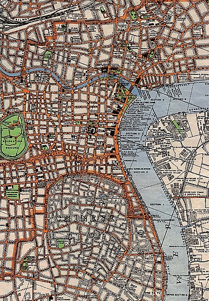
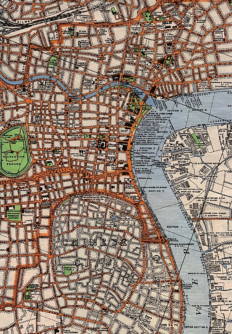
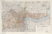
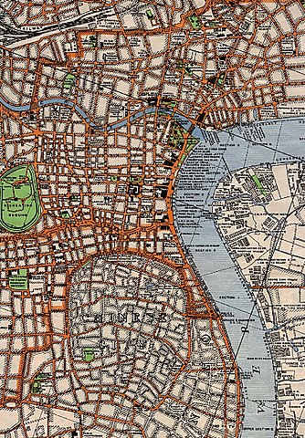
English: A portion of "Plan of Shanghai" (Sheet 1), original scale 1:15,840. "Heliographed at O.S. from drawings of the 1933 Municipal plan.
|
|||||||||
| Author | U.S. Army Map Service, 1945. | |||||||||
| Date | ||||||||||
| Source | University of Texas Perry-Castañeda Library Map Collection http://www.lib.utexas.edu/maps/ams/china_city_plans/ | |||||||||
| Geotemporal data | ||||||||||
| Bounding box |
|
|||||||||
| Georeferencing | ||||||||||
| Other versions | ||||||||||
The map was originally uploaded to w:Image:Shanghai 1933.jpg by w:User:Jiang.
This image is a work of a U.S. Army soldier or employee, taken or made as part of that person's official duties. As a work of the U.S. federal government, the image is in the public domain.
|
 |
File history
Click on a date/time to view the file as it appeared at that time.
| Date/Time | Thumbnail | Dimensions | User | Comment | |
|---|---|---|---|---|---|
| current | 20:56, 2 July 2005 | | 800 × 1,150 (641 KB) | Dbenbenn (talk | contribs) | PD, from w:Image:Shanghai 1933.jpg |
You cannot overwrite this file.
File usage on Commons
The following 3 pages use this file:
File usage on other wikis
The following other wikis use this file:
- Usage on cs.wikipedia.org
- Usage on da.wikipedia.org
- Usage on de.wikipedia.org
- Usage on el.wikipedia.org
- Usage on en.wikipedia.org
- Usage on es.wikipedia.org
- Usage on fa.wikipedia.org
- Usage on fr.wikipedia.org
- Usage on id.wikipedia.org
- Usage on it.wikipedia.org
- Usage on ja.wikipedia.org
- Usage on ko.wikipedia.org
- Usage on my.wikipedia.org
- Usage on no.wikipedia.org
- Usage on ru.wikipedia.org
- Usage on sh.wikipedia.org
- Usage on sr.wikipedia.org
- Usage on sv.wikipedia.org
- Usage on wuu.wikipedia.org
- Usage on zh.wikipedia.org